Explore!

Explore!

Monday, 28 December 2015

Sentinel Range


The Sentinels walk is a steep climb up a quartzite mountain range in the southwest.

There is a log to cross the river. The track is somewhat overgrown, but easy to fellow.

Starting point: Wedge River Picnic Ground


(Click images to view larger)

630 meters height gain to the summit


Mountain Pepper in the gully


The summit


Sunday, 20 December 2015

Rodway Range & Tarn Shelf


Mt Field Newdegate

The length is around 6 hours (with return). We took the Mt Field West Track first, and then the K Col Track (N), to the Tarn Shelf.

There are some parts where it would be hard to locate the track in fog.


Location: Mt Field National Park
Starting point: Lake Dobson


Lakes Belton (upper) and Belcher


Newdegate Pass
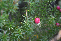
Creeping Pine Tasmania
Creeping Pine with small red berries


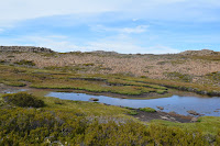
Highland Lake Tasmania
Lake Newdegate

Sunday, 13 December 2015

Deciduous Beech (or Fagus)

Beech Green Leafs

Deciduous Beech (Fuscospora gunnii) is a rare beech plant only found in Tasmania. It grows near lakes and tarns, mostly above 800m in high rainfall areas.

The leafs grow 1 cm long, turning yellow, orange, and red, in Autumn. The fruit is 6 mm.


Where to find some:
  • Cradle Mountain and the Overland Track
  • Lake Fenton
  • Tarn Shelf
  • Mt Murchison


Green Fagus
Near the Woodland Walk at Mt Field


Sunday, 29 November 2015

Lake Belcher


Sub-alpine Lake
This is a wet and muddy day walk located at Mt Field National Park.


Starts here


Past Wombat Moor...

Myrtle

Pandani
Pandani


Near the Humboldt River...

Reminder to take care with fire

Mountain Vally

Monday, 23 November 2015

Stacks Bluff

Stacks Bluff (1527 m) is the ninth highest mountain in Tasmania. It's located on the southern end of Ben Lomond National Park, the track starts at a forestry road above the old mining town named Storys Creek.

Take the first left after entering Strory's Creek from the west, from the car park walk up the track, there's a post with Stacks Bluff written on it.

This walk is difficult and should take 6 hours (with return).


(Click images to view larger)

From Storys Creek

In the forest

(In the forest)

Stacks Bluff

Tarn

We turned back at the plateau (1300 m)


Monday, 16 November 2015

Mt Wedge

Mt Wedge is 5 hours return, the track is over-grown. It goes in and out of some wooded rainforest containing a few pandani. There is no views until you enter the rocky area.

There is also Wedge Nature Walk which is 15 minutes return.

Lake Gordon was low.


Gordon River Road


Tree
Looks like Sassafras, and Myrtle (bottom-right)
May seem larger in photo


Mountains Tas
Mt Anne (left)


Mt Wedge Tasmania


Saturday, 7 November 2015

The Needles

The Needles


The Needles (little-known) track starts at the highest point of the Gordon River Rd, in the Southwest National Park.

Climbing Heath grows in this moorland as well as many other plants.

Length: 3km


Note that the mountains of Tasmania's Southwest wilderness are exposed.


How to find the track

The Needles
Find a rock cam on the other side of the road
Then do a U-turn here to the 
walker registration booth


More Photos

Mt Field West behind nearby peak

Looking over the Gordon River Rd

Wednesday, 9 September 2015

Waterfall Bluff

Waterfall Bluff
This track starts at the small parking area at waterfall bay in Tasman National Park. The walk is 2 hours return.

Please note that there are no guard rails on this track.


Waterfall Bay
Waterfall Bay


Forest
Forest


Small Waterfall
Small waterfall

Fern
Ferns


Saturday, 29 August 2015

Lake Sorell

Note: this lake is closed for fishing until further notice.


Lake Sorell is a lake south-east of Great Lake. It is used for fishing.


What it has:

  • Lake
  • Woodland
  • Fishing
  • Nearby lake

Location: Interlaken, Tasmania, Australia


How To Get There


There is 4 roads going to this lake. 


From Bothwell go up Dennistoun Rd (C529), keep driving to a view of Lake Crescent, soon later turn right at the Interlaken Rd, and then turn left to a small road, which will lead you to a boat ramp.


From Tunbridge take the Tundridge Rd.


Lake Sorell
The lake

Tuesday, 30 June 2015

Pine Lake

Pine Lake is home to Pencil Pine.


Type: walk

Length: 30 minutes return

Difficulty: easy

Highlights: large amount of Pencil Pine

Location: Great Western Tiers, Tasmania, Australia


How to get there


Take the Lake Highway, the walk is between Great Lake and Projection Bluff.


Pine Lake

Platypus Tarn

Trans Tasmania
Platypus Tarn is a tarn next to Lake Seal.


 Type: walk

Length: 30 minutes return

Difficulty: Moderate

Highlights: Tarn and forest

Location: Mt Field National Park, Tasmania, Australia


How to get there

Enter the park on the B61. Once you are in the national park drive on the road going up the mountain. The track to the tarn is pass Lake Dobson and just past Eagle Tarn.


Sub-Alpine Snow
Sub-Alpine Woodland with Tasmanian Yellow Gum
Snow Mt Field
Snow